

zaterdag 16 mei 2009
maandag 11 mei 2009
Thank You so much!
Thank you very much Jing Munoz of Colonial Grill, Legazpi (Albay district)! You and your crew have helped us SO much with translating the survey into Bikol. And that at the very last minute... Once again this is excellent proof of the friendliness of the people here and the will to help make a change. Yes, we can!

maandag 4 mei 2009
Interview with Engr. Macario Pavia, Provincial Planning Development Coordinator
What is the influence of disasters on regional planning?
A regional plan consists of several aspects like a health plan, social welfare, etc. Disaster Risk Reduction fits into the overall plan in a similar way.
What do you think about the discovered expansion of the city (north and west) as opposed to the south?
It is understandable that people keep on going there, for the existing settlements have been there for a long time. The disaster risk used to be smaller and people tend to accept that risk. Now it is difficult to move the people elsewhere, even if the risk is increasing. Many of them only live for today and do not think about the future.
The development to the south should be encouraged and it could become part of the provincial plan. One element of the plan is GUICADALE (Guinobatan, Camalig, Daraga, Legazpi). We intend to encourage developments to the south of these cities, supported by an international airport.
Is this part of the Naga - Legazpi growth corridor in the regional plan submitted by the NEDA (National Economic Development Agency)?
Not really, that plan is a bit outdated. It focussed on linear development along the national hihway. Now we are developing roads perpendicular to that. The GUICADALE area is in the crossroads of the whole Bicol region and could serve as a centre.
What is the role of Legazpi in all this?
Legazpi should invest in protective constructions. Along the riverbanks for instance. And they should build resettlements before the disasters hit in stead of after.
Mr. Daep suggested buying potential victims out in stead of spending money on resettlements. What do you think about that strategy?
The first problem is money, where would we get it from? And secondly, what will happen to the vacant lands? If it is owned by the government, you can be sure that squatters will settle there. That has happened to all the other government owned land. The government can’t do anything about it, for it would be to harsh to kick them away and by not addressing the problem, it doesn’t become one. If it would be addressed however, who would have the funds to solve it?
The squatters do not care if they live on potential hazardous locations. Once again, they only live for today and they are happy if they can get some food and drink. One day they are happy and the next they are sad...that is the way their lives are.
woensdag 29 april 2009
Interview with Cedric Daep, Provicial Disaster Coordinator
What is the influence of the PDCC on regional planning?
We get risk info from different sources, indicate risk zones, make policies to avoid investment in those zones, make maps about this, plan investments.
Participation of smaller scales (cities, communities)is necessary...
What are the different scenario’s?
We are familiar with the threats of the volcano. There are flood prone area’s along the coast and Yawa river... Many squatters reside here. Then there is an earthquake problem with the squatters. They have built on swamplands, without approved constructions and poor foundations.
Best would be to regulate land elevation constructions within building code. Like Pacific Mall did (after consultation with the PDCC), no damage.
What do you think about the discovered expansion of the city (north and west) as opposed to the south?
The expansion towards the north is concerning. Regional expansion is planned to the south - west of Daraga, Camalig, etc. With a new international airport, perpendicular roads (national government funding) and other incentives. 10-20 year projections. This will bring livelihoods to the south of Legazpi (where most of the resettlement area’s are now).
Legazpi can not grow in that direction, (the west) what will happen?
Legazpi might shrink... If the mayor of Daraga is an aggressive developer, Daraga will make Legazpi look small.
So what should Legazpi do?
Slow down new investments, especially in risk area’s. Someone should overlay a risk map over the city. (At this point we showed him our work on that. ed.)Relocate the Regional Offices to safer locations, invest in protective civil works, like dykes along the river. This last point is the main recommendation.
What and how is the cooperation with NGO’s?
We work with the bigger NGO’s (IFRC, World Vision, Committee on Migration, Agencia Espanyola, a Japanese governmental agency). We are looking for long term commitments, UNDP is planning resettlements in Legazpi now. We provide them with information and they provide us with info and help.
What is your relation to resettlement area’s?
We provide certifications, after the city has pointed out locations. These certifications are a obligation. The cities plan the area’s according to the land available within the city limits. Landownership can be quite a struggle...After that we help the NGO’s with aiding in the form of shelter. I have a strategy for resettlement... In stead of providing shelter, we should buy up the lots and land in risk area’s and let people decide where to move with that money. That way they can look for their own livelihoods. Obviously money is a problem here...
Previously Legazpi has indicated economic growth zones to the South, near Banquirohan resettlement site, but these never took of. It seems that development to the south is destined to fail?
First we need to invest in roads, water, electricity. These are the main catalysts for development, as you can see on the maps. We are trying to catch up with these issues, but here in the Philippines development is slow and we have other priorities. Once basic infra is available, then can we provide incentives and will investors move to these area’s.
donderdag 23 april 2009
woensdag 22 april 2009
Holy week, volcanic energy, city plans and fishing

Except witnessing all this holiness we were able to visit a site called Bacman Geothermal Power plant. Bacman refers to the location Bacon - Manitou. This site is situated just south of Legazpi, high up in the hills (actually a dormant volcano). On the plane from Manila to Legazpi I got talking to Ely who works for the EDC (Energy Development Cooperation) and is responsible for the water supply of the plant. Arguably he has the best office in the world. I wish I could let you see the view...

He was so kind as to show us around and according to him this is the cleanest and most environmentally friendly type of energy in the world. I suppose this statement could be true, but personally I have my doubts. The reasons: First of all the company has gone through great lenghts to make the site look green. There is a wonderful butterfly garden (supposedly the lifespan of a butterfly is an indicator for the air quality). And there was a small reserve for wild animals like boars, dear and horses (what is the relationship here?). Close by is a garden were seedlings are being grown to be replanted on the hillsides and to help the flying fox (bat) population. Coco mats are being used on hillsides to prevent erosion, when plants can not do the job (actually quite interesting). So, in conclusion, a lot of 'green' image. A quick look at the website indicates a similar pattern.

But the same cooperation is involved in oil and gas drilling and these activities receive a lot less attention... The actual plant is from the 70-ies, and now not in the best condition anymore. Surely in the 70-ies green energy was not the same thing it is today? So, what is more likely, is that this form of energy is cheap and only lately has become 'green' and of course a good way of presenting the company to the world. We have heard some fishermen in Bacon-beach are suing the company for ruining their source of income (some type of shellfish), but this relationship has not been proved yet. As we will be able to read in one of the next paragraphs, most fishermen are having difficult times now in most places anyway...
In conclusion I would like to point out that I am simply taking a critical position here and that I am actually not capable of judging the degree of greenness of this company. It may well be the most clean and durable form of energy in the world and what we saw was very inspiring in every way. So, thank you Ely for showing us around and keep up the good work!
In the meantime we have established contact with the City Planning Department of Legazpi and spoken with chief engineer Joseph Estrada. Most call him Joy and that nickname captures him well. He has presented us with the current plans, maps and documents. It turns out that there is quite some data available, but that is mainly from before the typhoon year 2006. We were able to process parts of this data into maps, some of which will be downloadable from this website. The office is still catching up with the digital revolution, so most resources are still paper. We are cooperating well and can now come into the office without appointment, which really helps us and speeds things up. We hope (and expect) this department will be very happy with our work and the maps we will present them. Now we are focusing on the different resettlement area's and are planning our 'field integration' phase. This means we will each live in these sites for a certain amount of time.
Last weekend consisted of a field trip to San Miguel island, not far from Legazpi. This island faces the pacific and together with a number of others islands forms the first barrier to the typhoons coming in from the west. On the island were only paths, so no cars. We were actually able to transport our bike on the small boat. Things on the island are still very primitive (showers at the water pump), but paradisaical: intimate rice fields with caribou, green hills, occasional grand views to the ocean and houses freely scattered about. Pineapples from the garden...I even saw a small black and white t.v, maybe the last in the world?

The main source of income is fishing for the men and making mats of palm leaves for the women. Fishing is really becoming a problem. There was a marine sanctuary, established in the early 90-ies, but the typhoon (Reming) destroyed everything. In 10 years the coral had grown about 1 cm and it was all destroyed in one day. After this event, the barangay captain had no choice but to open up the reserve for fishing, and in doing so further destroying the ecosystem. In surrounding barangay's dynamite fishing is still an issue... Because there is not enough fish, a number of fishermen are on 'standby', I believe it is not hard to imagine what this means...
The mats are being sold for about 60 Pesos (1€) for a size of 3 by 2,5 m. My estimation is that this is proportional to about 4 or 5 hours of work.

In my view, this case illustrates the Philippine condition perfectly. The way of life of these people is so very much based on living from day to day and harvesting their needs from the nature. For a long time this was a balanced system (nature was able to provide), but now with the climate change, overfishing and of course population growth, the balance is off. It is a battle for niches and these people are losing. All developments and investments come from outside the island through NGO's and government, such as the funds for the sanctuary or the programme for organic farming. When the typnoon hit, all investments were lost and even further destroyed by the people, again making them dependent on foreign aid. I think their is a need for a mentality change. These people need to realise the importance of sustainable development (so no dynamite fishing!) This means making sustainable (small scale) investments, taking responsibility and changing the day tot day lifestyle. It also means that there should be a possibility for that aided by the government and NGO's. Micro-credits could help here. I believe fish farming or aqua cultivation has great possibilities here, and i have already met someone who became rich by it. It could well work on the barangay level.
The irony is that our idea of development brings material goods and freedom of choice, but takes away the freedom of the day to day unplanned lifestyle. It is a Catch 22 situation.
To end with something amusing... The Philipines is supposed to have 7107 islands, most people know that here. I was discussing this fact with a local and we were wandering how 'island' is defined. When does it stop being a rock, surrounded by water, however small, and when is it really an island. We came to the conclusion that you need at least one tree to be classified as an island (the stereotypical deserted island with one coconuttree). And we were further wandereing who had actually counted all these islands, and if it would be possible that he or she would have made a mistake in counting them. This being the Philippines that would be very likely. So, now (for us), the Philippines consists of roughly 7000 islands, give or take a 1000...
The question of decentralization
The following text consists of a number of emails between Alexander Vollbrecht and me.
Hi Alex,
Before I went to the Philippines, I read somewhere that Davao (a southern city) is the second biggest city in the world measured by land area. I thought that was a remarkable fact. One look at Google Earth gave me a green checkered image, indicating a high level of agricultural integration. And indeed, as it turns out here the best agricultural products come from Davao.
The 'urban and development housing act 1992’ is the most important national guideline document in developing urban and regional plans. The main concern is social housing and development of dwellings for the deprived. These topics are strongly related to our research here. The only real political statement about space can be found in the next clause:
Sec. 38. Urban-rural Interdependence. — To minimize rural to urban migration and pursue urban decentralization, the local government units shall coordinate with the National Economic and Development Authority and other government agencies in the formulation of national development programs that will stimulate economic growth and promote socioeconomic development in the countryside.
Decentralisation, but why (since in Europe the tendency is the opposite)?
First I have to note that there is a nostalgia for the countryside, but this explanation seems to be a little naive.
Seccondly, in the tropics, and in the Philippines especially, the class separation is much more apparent then in other places I have been. You don’t need a lot to survive and that means there is an underdeveloped and very poor lower class. As a result wages are very low and for every job three people are hired. The gap between the people that have been able to develop somewhat is quite large and so these people are used to being served.
Is the act of decentralization a way of keeping this class separation in tact? But as far as I can see, it are the leftist movements who promote decentralization. This is in concurrence with what I read and hear and with the rest of the document mentioned earlier. This is what Henri Lefebvre states in ‘The Urban Revolution’:
How can we overcome the town-country dichotomy? Through the disappearance of large cities, by scattering businesses throughout the countryside. The antiurban urbanist movement made its debut shortly after the October revolution, according to Anatole Kopp. Although it resulted in projects remarkable for their architecture, it failed as an urban project. Soviet cities continue to grow in terms of size, productivity, and political importance to this day. In other words, in spite of the efforts of utopian thinkers at the exact moment when they thought they were being most realist and rational, the urban revolution in socialist countries proceeded without a conception of the urban that differed in any significant way from what was found in capitalist countries. Their political projects follow a distinctly anti-city line. And this is true even today, in Cuba and elsewhere.
Is it then, like this text suggests, a question of negligence. Clinging to old ideals? That would somehow explain why most cities here have such a messy character and consist of large parts of agriculture. And it would explain why the current guidelines are all the way back from ’92...
Still, I have the feeling that something else is the case. Maybe it does have a relationship with the class struggle? Or is it possible that the finished scenario is totally de-urbanised: a complete acceptance of both urban and non-urban functions in a integrated countryside, as the case of Davao suggests.
Alex, I have the feeling that you are able to help me with these questions, so I would really appriciate your answer.
Kind regards,
Berend
Dear Berend, having returned from London and New York, I now read your interesting observation which directly spawns a series of reflections...
The dichotomy between ‘urban and rural’ as proposed and contested by numerous scholars in the past century, yet its interrelation with economic progress and development has not been clearly understood. The position from Lefebvre proposing that we see the ‘the urban' not merely within an ‘urban-rural-nature’ divide, but to embrace it as an ‘urban field’ upon which various degrees of urbanization processes crystallize, is one that I too encourage (as it does not create artificial boundaries). The surface of the world is undergoing various forms of transformation and the continuous interrelationship between different forms of production (including agricultural) are all part of the same urban system (in various space-time scales). I too am under the belief that an interdependent urban form wherein centralized and decentralized processes intertwine offers the highest form of ‘affordance’ (understand this term as generating a space that can afford, or accommodate, as much diverse undertakings as possible).
After being asked to propose a development plan for a village of 70 families in Perica (Marowijne region in west Suriname) in 2005, who were living in a predominantly green environment in the Amazon, every intervention proposed would gradually take them from a ‘natural’ environment into an ‘urban’ environment. In an attempt to transcend this outcome, we proposed that we seek for a development scenario that would strive to create a ‘natural urban ecology’, striving to take the best that each environment offers. This meaning, that one would need to understand the productive value of various form of livelihoods and engagement. If you understand ‘development’ as that which is only oriented at economical and technological progression, this may (and often does) undermine/inhibit other forms of production (e.g. social, cultural and spiritual). Thus we strived to engender a holistic form of development that includes (thus not exclude) the multiplicity in a well balanced manner. We proposed that this can only be done if any (and all) proposed strategies ‘invest first in people and planet, with pleasure and profit as a result’ (this is also the vision of Cross Border Relations as lectured by Roy Silos during our preparation month). What we often find in our Western cities, is that development has tended to prioritize profit and pleasure first, with detrimental consequences for people (culture) and planet (nature). Those absorbing the Marxist viewpoint, which can be found in many leftist, socialist or communist perspectives, fail to include the required economic progression needed to create a sustainable and progressive milieu. Economic advancement, measured through material gain (finance, assets, etc) often out ways the advancement of the hidden fields (social, cultural, spiritual) and is usually preferred. Only when systems near states of crisis does a revisiting of its attitudes take place.
I believe that a fully integrated system, wherein a holistic humanistic (e.g. socialist) concern is upheld whilst offering possibilities for individual (e.g capitalist) growth would be a utopian (and even viable) model. In the case of Philippines it seems that the majority has been offered a way of life (to survive), but not necessarily a way of life to progress. At CBR we refer to a well-balanced progression as ‘prosperity’, which is fostered through differentiation. If a city, or urban fabric utilizes a singular spatial model for development, this eventually leads to stagnant phase – regardless of which model is used. As such, you can start to deduce that areas that are highly centralized can foster high speeds of exchange, development and progress, yet often complimented with various consequences (high socio-economic inequity, environmental deprivation, etc); whereas areas that use pure decentralised spatial models foster limited exchange and often slow development and limited progress (as in the case of Philippines). ‘Opening up’ the centralised spaces in our city cores (e.g. urban agriculture) is one type of response to this, and one can imagine that ‘centralizing’ (e.g. densifying) decentralized open spaces may offer new layers of opportunity that compliment current ongoing spatial economies (how and in which way to do this is complex challenge and cannot be created through a simply program driven approach). I should also mention here that the current model which gives value to different types of economies is also a conditioning factor (city economy versus rural economy). As they say, the subsidized agriculture of Europe plays a big role in the agricultural production and its value in developing countries (e.g. A cow in the Netherlands earns more then a farmer in Africa.)
Other aspects I also wanted to share, after having spoken to some of the groups, coming from our experience working on development issues in Suriname, is the conditions that come about under politically instable environments, namely that it contaminates the entire ‘culture of development’. Inhabitants seem to develop purely short term and highly opportunistic attitudes. Any form of long term perspectives had been systematically broken down through years (sometimes generations) of disappointments and unclarity due to shifting political interests and directions. This is one of the hardest bottlenecks to surpass when striving to generate sustainable long term strategies together with local inhabitants. This is a key issue that you all should watch out for when hosting brainstorm sessions in which you invite inhabitants to share ideas as to how they themselves propose alternative strategies for development following future or past disasters. Simply asking someone how they see their future in 10 years is often too naïve (as they may not even be thinking that far ahead), and may lead to a superficial response. On the phone I’ve proposed to some of you that although we won’t be making full proposals to enhance the development from disaster work at this stage of the research, you should of course use your time there to stage creative brainstorm sessions/workshops to properly document ideas that come from the people themselves (whether from an inhabitant, municipal worker or local NGO). It has come to my attention from the last set of conferences I’ve been to that there is a growing interest to learn more from local knowledge (the ‘genius loci’ of an area) in response to disaster situations. I would like to ask all of you to look into this as well.
Hugs from an incredibly sunny NL!
Alexander
Hi Alex,
Thanks for your answer, it does clear up a number of things for me.
First of all I recognise the concept of the 'urban field' with accompanying crystallisation processes. This seems a very workable concept and indeed does not create any (artificial) boundaries. Would it however be possible to think of a medieval town without thinking of the contradiction between town and country? In this specific case the processes that take place (farming and selling) are very much intertwined, but the spatial character is so strongly opposed...
In a village in the jungle this opposition would be similar, as you have pointed out. I like the idea to strive for the natural urban ecology, integrating spiritual traditions. I believe this holistic concept resembles the sustainable development triangle: people, nature, economy. That always helps me to define sustainable...
I think that it would be interesting to look at strategies to densify and bring developments to the resettlement area's and simultaneously contributing to the city as a whole... As for the last paragraph, that really describes the case here in the Philippines very well. When talking about development, people can not go without mentioning the government and the corruption involved in it. It is hard to imagine how frustrated the people are with that, when you haven't really experienced it yourself. But often I think it is also a way of ignoring responsibilities. But will will definitely find a way to incorporate some local knowledge into our research.
Thanks again, keep well,
Berend
Hi Alex,
Before I went to the Philippines, I read somewhere that Davao (a southern city) is the second biggest city in the world measured by land area. I thought that was a remarkable fact. One look at Google Earth gave me a green checkered image, indicating a high level of agricultural integration. And indeed, as it turns out here the best agricultural products come from Davao.
The 'urban and development housing act 1992’ is the most important national guideline document in developing urban and regional plans. The main concern is social housing and development of dwellings for the deprived. These topics are strongly related to our research here. The only real political statement about space can be found in the next clause:
Sec. 38. Urban-rural Interdependence. — To minimize rural to urban migration and pursue urban decentralization, the local government units shall coordinate with the National Economic and Development Authority and other government agencies in the formulation of national development programs that will stimulate economic growth and promote socioeconomic development in the countryside.
Decentralisation, but why (since in Europe the tendency is the opposite)?
First I have to note that there is a nostalgia for the countryside, but this explanation seems to be a little naive.
Seccondly, in the tropics, and in the Philippines especially, the class separation is much more apparent then in other places I have been. You don’t need a lot to survive and that means there is an underdeveloped and very poor lower class. As a result wages are very low and for every job three people are hired. The gap between the people that have been able to develop somewhat is quite large and so these people are used to being served.
Is the act of decentralization a way of keeping this class separation in tact? But as far as I can see, it are the leftist movements who promote decentralization. This is in concurrence with what I read and hear and with the rest of the document mentioned earlier. This is what Henri Lefebvre states in ‘The Urban Revolution’:
How can we overcome the town-country dichotomy? Through the disappearance of large cities, by scattering businesses throughout the countryside. The antiurban urbanist movement made its debut shortly after the October revolution, according to Anatole Kopp. Although it resulted in projects remarkable for their architecture, it failed as an urban project. Soviet cities continue to grow in terms of size, productivity, and political importance to this day. In other words, in spite of the efforts of utopian thinkers at the exact moment when they thought they were being most realist and rational, the urban revolution in socialist countries proceeded without a conception of the urban that differed in any significant way from what was found in capitalist countries. Their political projects follow a distinctly anti-city line. And this is true even today, in Cuba and elsewhere.
Is it then, like this text suggests, a question of negligence. Clinging to old ideals? That would somehow explain why most cities here have such a messy character and consist of large parts of agriculture. And it would explain why the current guidelines are all the way back from ’92...
Still, I have the feeling that something else is the case. Maybe it does have a relationship with the class struggle? Or is it possible that the finished scenario is totally de-urbanised: a complete acceptance of both urban and non-urban functions in a integrated countryside, as the case of Davao suggests.
Alex, I have the feeling that you are able to help me with these questions, so I would really appriciate your answer.
Kind regards,
Berend
Dear Berend, having returned from London and New York, I now read your interesting observation which directly spawns a series of reflections...
The dichotomy between ‘urban and rural’ as proposed and contested by numerous scholars in the past century, yet its interrelation with economic progress and development has not been clearly understood. The position from Lefebvre proposing that we see the ‘the urban' not merely within an ‘urban-rural-nature’ divide, but to embrace it as an ‘urban field’ upon which various degrees of urbanization processes crystallize, is one that I too encourage (as it does not create artificial boundaries). The surface of the world is undergoing various forms of transformation and the continuous interrelationship between different forms of production (including agricultural) are all part of the same urban system (in various space-time scales). I too am under the belief that an interdependent urban form wherein centralized and decentralized processes intertwine offers the highest form of ‘affordance’ (understand this term as generating a space that can afford, or accommodate, as much diverse undertakings as possible).
After being asked to propose a development plan for a village of 70 families in Perica (Marowijne region in west Suriname) in 2005, who were living in a predominantly green environment in the Amazon, every intervention proposed would gradually take them from a ‘natural’ environment into an ‘urban’ environment. In an attempt to transcend this outcome, we proposed that we seek for a development scenario that would strive to create a ‘natural urban ecology’, striving to take the best that each environment offers. This meaning, that one would need to understand the productive value of various form of livelihoods and engagement. If you understand ‘development’ as that which is only oriented at economical and technological progression, this may (and often does) undermine/inhibit other forms of production (e.g. social, cultural and spiritual). Thus we strived to engender a holistic form of development that includes (thus not exclude) the multiplicity in a well balanced manner. We proposed that this can only be done if any (and all) proposed strategies ‘invest first in people and planet, with pleasure and profit as a result’ (this is also the vision of Cross Border Relations as lectured by Roy Silos during our preparation month). What we often find in our Western cities, is that development has tended to prioritize profit and pleasure first, with detrimental consequences for people (culture) and planet (nature). Those absorbing the Marxist viewpoint, which can be found in many leftist, socialist or communist perspectives, fail to include the required economic progression needed to create a sustainable and progressive milieu. Economic advancement, measured through material gain (finance, assets, etc) often out ways the advancement of the hidden fields (social, cultural, spiritual) and is usually preferred. Only when systems near states of crisis does a revisiting of its attitudes take place.
I believe that a fully integrated system, wherein a holistic humanistic (e.g. socialist) concern is upheld whilst offering possibilities for individual (e.g capitalist) growth would be a utopian (and even viable) model. In the case of Philippines it seems that the majority has been offered a way of life (to survive), but not necessarily a way of life to progress. At CBR we refer to a well-balanced progression as ‘prosperity’, which is fostered through differentiation. If a city, or urban fabric utilizes a singular spatial model for development, this eventually leads to stagnant phase – regardless of which model is used. As such, you can start to deduce that areas that are highly centralized can foster high speeds of exchange, development and progress, yet often complimented with various consequences (high socio-economic inequity, environmental deprivation, etc); whereas areas that use pure decentralised spatial models foster limited exchange and often slow development and limited progress (as in the case of Philippines). ‘Opening up’ the centralised spaces in our city cores (e.g. urban agriculture) is one type of response to this, and one can imagine that ‘centralizing’ (e.g. densifying) decentralized open spaces may offer new layers of opportunity that compliment current ongoing spatial economies (how and in which way to do this is complex challenge and cannot be created through a simply program driven approach). I should also mention here that the current model which gives value to different types of economies is also a conditioning factor (city economy versus rural economy). As they say, the subsidized agriculture of Europe plays a big role in the agricultural production and its value in developing countries (e.g. A cow in the Netherlands earns more then a farmer in Africa.)
Other aspects I also wanted to share, after having spoken to some of the groups, coming from our experience working on development issues in Suriname, is the conditions that come about under politically instable environments, namely that it contaminates the entire ‘culture of development’. Inhabitants seem to develop purely short term and highly opportunistic attitudes. Any form of long term perspectives had been systematically broken down through years (sometimes generations) of disappointments and unclarity due to shifting political interests and directions. This is one of the hardest bottlenecks to surpass when striving to generate sustainable long term strategies together with local inhabitants. This is a key issue that you all should watch out for when hosting brainstorm sessions in which you invite inhabitants to share ideas as to how they themselves propose alternative strategies for development following future or past disasters. Simply asking someone how they see their future in 10 years is often too naïve (as they may not even be thinking that far ahead), and may lead to a superficial response. On the phone I’ve proposed to some of you that although we won’t be making full proposals to enhance the development from disaster work at this stage of the research, you should of course use your time there to stage creative brainstorm sessions/workshops to properly document ideas that come from the people themselves (whether from an inhabitant, municipal worker or local NGO). It has come to my attention from the last set of conferences I’ve been to that there is a growing interest to learn more from local knowledge (the ‘genius loci’ of an area) in response to disaster situations. I would like to ask all of you to look into this as well.
Hugs from an incredibly sunny NL!
Alexander
Hi Alex,
Thanks for your answer, it does clear up a number of things for me.
First of all I recognise the concept of the 'urban field' with accompanying crystallisation processes. This seems a very workable concept and indeed does not create any (artificial) boundaries. Would it however be possible to think of a medieval town without thinking of the contradiction between town and country? In this specific case the processes that take place (farming and selling) are very much intertwined, but the spatial character is so strongly opposed...
In a village in the jungle this opposition would be similar, as you have pointed out. I like the idea to strive for the natural urban ecology, integrating spiritual traditions. I believe this holistic concept resembles the sustainable development triangle: people, nature, economy. That always helps me to define sustainable...
I think that it would be interesting to look at strategies to densify and bring developments to the resettlement area's and simultaneously contributing to the city as a whole... As for the last paragraph, that really describes the case here in the Philippines very well. When talking about development, people can not go without mentioning the government and the corruption involved in it. It is hard to imagine how frustrated the people are with that, when you haven't really experienced it yourself. But often I think it is also a way of ignoring responsibilities. But will will definitely find a way to incorporate some local knowledge into our research.
Thanks again, keep well,
Berend
woensdag 8 april 2009

vrijdag 3 april 2009
dinsdag 24 maart 2009
From Lagazpi to Iloilo
Legazpi to Samar island
After spending five days in Legazpi it was time to move on to Iloilo, but getting there was a different story because we wanted to travel by land to see the countryside. One of our friends, Brother Raoul, a.k.a, Rocky had offered us a ride all the way to Calbayog, so once again we experienced the great generosity and kindness of the people here.
On Saturday morning we drove to Matnog, from were we took a ferry to Allen. Due to an unknown delay our ferry took of one hour later. So once we got off the ferry we were in a hurry to catch the next ferry to Cebu which was leaving at seven o’clock. Unfortunately the roads on Samar island are not as good as in Luzon. There were big holes and it was dark already. We arrived in Calbayog at 19.16 hour. We missed the ferry!
Now we were stuck on Samar till Tuesday. A city where nothing really happens and only a handful hotels are located there.
This gave us the opportunity to evaluate Legaspi and Cavite, and also to update our finance.
Through Brother Rocky we met a woman named Rofel. She took care of us during our stay. She showed us around and told us about her study, and her migration to the States. This is a common think in the Philippines, and actually a big problem. Therefore you have to work for three years in the Philippines before you get your diploma. This is one of the rules that the new President, Gloria Macapagal-Arroyo, proceeded.
 Berend, Sanne, Rofel and Evert
Tuesday afternoon we were finally on our way to Cebu. Because there is no direct connection to Iloilo we had to travel over Cebu. This is a twelve hour trip with hundreds of beds on the deck and one Videoke set on board to sing along.
We arrived the next morning in Cebu city. An industrial city that seems to be well developed. After spending half a day there, we took off with the next ferry to Iloilo city. We spend the night on the roof, under the stars. And dolphins swimming next to us.
 Our bed on top of the ferry
Iloilo
After 12 hours we finally arrived in Iloilo city. We dropped our bags at the hotel, and went to Jaro, a district off Iloilo witch was most effected during typhoon Frank. We already knew that this was the most vulnerable place of Iloilo city. This is also the place where the most informal settlement are located.We were invited by Ramos into his house.
 Ramos' crib
 Water level still visible
Meeting with the UAP,
Back in the hotel we by coincidence met an architect who’s office is located in the Hotel. His name is Mel and he is also a member of the UAP, the United Architects of the Philippines.
He invited us that same night to join him for a meeting with the UAP, they attend every month. They gave us a warm welcome, and we were placed at the last table were the big boys are seated. After a dinner and some beers the presentation finally began. First we had to introduce ourselves, which was pretty unexpected especially because we had to talk into a microphone which isn’t very easy to do.Still it was fun to be part of a meeting from the UAP.
The planned presentation was about new materials, like Ecofoam, which is a foam and easy to use and better than other isolating materials, according to the salesman of course. After being criticized by the big boys, the salesman could finally finish his presentation.
 salesman at UAP meeting
Exploration Iloilo city,
The next day we went to see the city planner off Iloilo, which we already met at the meeting the night before. In the office they showed us maps of Iloilo city, which contained the new flood project, the relocation plans of the airport out of the city and the new ring road which will reduce the heavy traffic in the city centre. On the maps you could see resettlement areas as well, this because they are making some roads wider and therefore the houses which are located near the road will be relocated. Also the settlers who lives on the river banks, have to be relocated as well. This because of the danger and new regulations from the government. The plan is that there will be no building structure within twenty meters from the river. This of course for there own safety and environmental concerns.
 one of the maps with cityplanners
We met with the president of DENR, Department of Environmental and Natural Resources, Mr. Bing Garnace. They are planting new trees on the riverbanks more upstream. They also intend to process this into the city, once the squatters are gone. This for holding the soil and to prevent future mudslides.
After these three day’s of exploration in Iloilo, we came to the conclusion that Iloilo is actually well developed and is not heaving severe problems after the flooding. They managed to build the destructed homes back in one month time, because the structure itself was still standing and the removal of informal settlements was already in progress, with or without the flood due to typhoon Frank.
The political situation in Iloilo is more the problem these days. Corruption is a major problem as well. In fact The Philippines is the third most corrupted country in the world.
After DENR we went to the NDCP-DND, The National Defense College of the Philippines-Department of National Defense, and talked to Eligio R. Calaor. He send us to Ir. Jose Papa from the ICDCC, Iloilo city- Crisis and Disaster management Centre. Papa was told us more about the government and the corruption. We requested for some maps and plans of Iloilo city which he could not provide us, but Mr. Rony Haresco Firmenza from ICUPAO, Iloilo City Urban Poor Affairs Office, should. He showed us the design of the relocation settlement in the Jaro district.
vrijdag 13 maart 2009
Exploration of Lagazpi City
Wednesday 11 and Thursday 12 March
We travelled to Lagazpi city early morning on Wednesday. We still have to get used to the daily routine here, because people tend to start their days really early! Schools start at 7 am, so people get up around 6. This is about the time when the sun comes up. We have noticed that this is true for most of our UE - case countries.
After arriving we were picked up by Rico Locaba, from Heifer, and introduced to Sir Felix Ador. He is the head of the Aquinas University Foundation Inc. We had a meeting with them and received a very warm welcome on the university campus. We were introduced to Father Ramon Mendez, rector of the university. He explained to us what the intention of the foundation was: a lot of students come from the provincial communities. The foundation brings the students and the education back into the communities so that they can learn from each other. Projects consist of for instance water engineering and typhoon mitigation, but there was an acting programme as well. This last example helps to empower the poor and develop their sense of confidence about the future. Two lovely rooms at the campus were made up for us.
After lunch we met with Cedric Daep, head of the PDCC (Provincial Disaster Coordinating Council). He was very enthusiastic about our research and said that this is exactly what is needed to develop long-term sustainable solutions. At the moment there are practically no maps at all. Albay is the only province with a separated pre disaster preparedness workgroup in the Philippines. (This task is normally incorporated within the post disaster workgroup, also called a (x)DCC, with (x) representing any scale of government) This seperation was the result of the three typhoons (of which Reming was the worst) that hit this province in 2006. The disaster was very complex: high wind speeds of up to 240 km/h, heavy rains, mudslides (Lahar's) from the Mayon volcano and different types of floods caused a massive destruction. After the typhoons, a quote 'typhoon of relief worker' s' engulfed the city. It seems that each NGO does it's work according to their own visions, not working together with government or each other and not reacting to local situations. Something we have to look in to...
Cedric gave us an example of this. The general conception of prevention of mudslides is to plant trees. However, in this case planting trees would only make it worse, because trees will catch heavy winds and shake and loosen the ground. This makes the ground more penetrable for water which will only increases the risk of Lahars. Some NGO's press for trees along the riverbanks to stabilise the earth, but when these trees fall over into the river, the water will not be able to escape. We conclude that disaster risk reduction is different in typhoon prone area's and that it is good that a man like Cedric Daep is in charge of the coordination.

Mt. Mayon is still very active and every now and then it deposits new rubble on the top. This will want to come down, and forms a potential risk for the surrounding barangay's (communities). One of the things he showed us on the map, was a clear circle of barangay's with a 8 km radius surrounding the volcano. These area's are all at risk. Even some resettlement area's are still at risk due to poor planning. The land here is very fertile and provides for what people here call livelihoods, a means of income. Resettlement area's often lack the land to produce foods. In Cedric's office we met with the local vulcanologist and he explained the Lahar principles to us. Basically, in his view, the whole of Lagazpi city is at risk to mudslides. The volcano is world famous for being perfectly cone-shaped, but this is simultaneously the same reason why the volcano is so unpredictable, the mud can flow of from each side. This news came as a bit of a shock to our escorts...
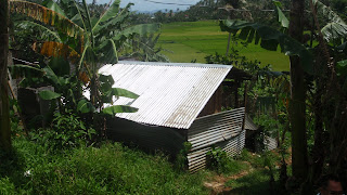
After that, Brother Raul and Floor, also connected to the AQFI brought us to Barangay Padang. This was one of the communities that was covered in mud and rubble after the typhoon. It was quite scary that we were actually walking on top of a large cemetery with many people and houses buried beneath the soil. The top part of a couple of the concrete structures were still visible. Some of the people had actually moved back to the site and started living there again. Admittedly this is a beautiful place, both at the foot of the volcano and on the sea shore. I can imagine why people would come back here.
The next day we were escorted by Brother Raul and Justin Cabrera, project manager of the CARESS Relocation Site in Legazpi city. We visited 5 different relocation sights this day, but this first sight definitely was the best, in our eyes. CARESS stands for City Assistance for the RElocation of Squatters and Slum dwellers. Originally this project was planned from Manila, covering the whole 3.9 ha. with plots. The plan was quite ridiculous, for half of the site was on a very steep hill. Through the work of Justin and others, the plans changed to incorporate a conservation park on the hill. Houses at the bottom have been, or will be transported a couple of hundred metres to saver locations. 98 plots have been laid out and materials provided. Water pumps have been placed. The people have built their own houses according to their needs and private gardens have been fenced. People grow their own foods in these gardens or on the conserved hill. Rice paddy's surround the site. In the coming months some infrastructual work will add concrete roads, stairs and drainage. This site resembled the traditional barangay's in the way people take care of themselves and build their houses.
Other site's were quite different. The main difference was the lack of difference. Other site's, most of them constructed by NGO's like Oxfam, Humanitas, etc. used one type of house (each NGO has an own type). This type was reproduced an x amount of times on a strict grid along paved roads. All basic needs were installed: water, sanitation, schools, communal space, but there was no space for agriculture. As a result people have to travel to the city to find work and spend a lot of money for this travelling. That was their main complaint about living in these places. Because of this, these site's resembled the mono-functional suburbs we know from the US or the VINEX from Holland. Nothing happened there... And on top of that the houses were suitable for a family of about 5, but when the families grow, they can not increase their living space, as they are used to do. Even though, we found small economic businesses: a sewing machine and a hair dressers in the back of one of these houses. The site's we visited were quite a bit larger compared to the first (except one). Here is a list: Taysan relocation site, Anislag (Daraga), St Francis of Assisi relocation site, Tagaytay (Camalig)

At the end of the day Brother Raul and Justin brought us to Smoke 'n Grill where we ate goat, snake and pig's face to accompany the SMG's (San Miguel Light). Page, a water engineer and American peace corps volunteer, joined us and advised to never order soup nr. 5. He has been here for 3 years and speaks the local Bicollano. He was able to explain what the different face expressions mean, like lifting eyebrows for yes and pursed lips combined with a certain direction for pointing at something. The night ended with a videoke session, as is the tradition here. Even in the poorest barangay's you will be able to find huge videoke (same as karaoke) installations.
The amount of life is so truly beautiful about the Philippines. Everything is full of it. The rice fields, the papaya trees, the bugs and bullfrogs, the eagles and lizards, the water, the people. There is a great understanding of this. Everything co-exists. That is why people will not steal from you, they would rather offer you some food. In stead of asking something like are you o.k., they will ask you: 'have you eaten' If you would ask about somewhere to sleep they will offer it to you. You have to be careful with your questions... This hospitality is something they are very proud of. If someone dies, the coffin will be placed inside the home for a couple of days and during this time everyone, even strangers, will visit and receive foods and drinks from the family. A poker table will be installed. Fun and Joy are celebrated every day, people love to make jokes, dance and sing. This is a very modest and beautiful country, it deserves to be up there with Thailand.
dinsdag 10 maart 2009
Visit school in Buyi, Bicol

We picked up one other person before we went to the school, she was an engineer / project planner who was in charge of the construction for the school buildings. She told us that all the schools are built according to national governments prescriptions and that is why all the schools look the same. (we observed that this is true) It seems schooling is very well organised in the  roofings. These cannot withstand strong winds and turn into razor sharp head cutters during typhoons. She recommended concrete slab roofing, but this was to expensive and not part of the governemental prescriptions. It is amazing to see how this material has found its way into the building industry. It is so multi-purpose, flexible and, most importantly, easy that you can find it practically anywhere. Uncoated the material only costs 50 pesos (1
After a long trip, we arrived at the school and accustomed to the Philippino tradition, we received a warm welcome. After drinks and a quick talk about what we do, we went for a tour around the school.
In the first place we saw the school from the streets, and you would never expect that behind the front building is this large playfield with more buildings around it. 
The head of the school showed us every building which consisted out three classrooms.
One building was totally destroyed and al the others were damaged, ceilings and whole roofs were blown away.
We saw new buildings which were realised by Unicef and the government (separatly). These seem to be well structured.
But the main problem was the lack of enough classrooms, because some buildings are not rebuild yet, there were too many children in one classroom, but on the other hand, there were not enough teachers, and maybe that’s why there were to many children in the classrooms…but still it’s a big problem.
We saw each classroom, with a warm welcome from all the children every time that we passed the classes: ‘Good afternoon principal, good afternoon visitors welcome to class 1, please have a seat’.
It was very impressive to see what happened to the buildings on old photographs. Everything was underwater, because of all the rainfall. All the water came to the lowest point, which is were the school is positioned.
The people could evacuate into the school during the typhoon, but after that you couldn’t stay there, otherwise you would sleep underwater…
After a long stay in the school and some good talks with the staff, we had to move on.
We went to a lake where the smallest fish of the world are being caught and turned into fish-crackers. They are less than a centimetre long. We haven’t tried it yet.
zondag 8 maart 2009
Tour with Neneng (PRRM)
 At six ‘o clock in the morning Neneng and Sharon from the PRRM picked us up to start our tour around the area of Cavite. Sharon is actually an English marine biologist who now lives in The Philippines. First they took us to a reforestation project. Here they plant new Mangrove plants to stimulate the fish productivity and also to get the Mangrove back again. This is in itself a natural boundary in case of i.e. typhoons and floods. They plant the Mangrove and learn the local community there how to take care of them. They also introduced us to the chief of the community who was really kind and pleased to meet us. After that we drove to a landfill the PRRM and other NGO’s and organizations are demonstrating against. It causes in many ways big problems as landslides and pollution, effecting the natural environment. It’s also against the governments own policy because they made the area too large and too close to a river, which will directly infect the water system of the downstream situated village. Next we visited two women who strive to eat and culture more organic local vegetables. They want to set up a program to learn people how to do this, so they can practice this at home in their own backyard. After this we went back to Manila and they arranged for our bus trip the next day to Naga, near Legaspi. We could spend the night in the dormitory at the PRRM building, and we had a lovely evening with them on the roof terrace.
Fisherman boot

Landfill


interview Neneng
vrijdag 6 maart 2009
Arrival
 After an exhausting trip we finally arrived in Metro Manila! A very crowded city full of American influances such as fastfood chains, malls and billbords. The next day we had our first meeting with Neneng and Guyi who are working for the PRRM (Philippines Rural Reconstruction Movement). They gave us a very warm welcome with a tipical organic Philippine meal , and we gathered some useful information not only for our research, but also about the Philippines and some practical stuff. After that we explored the city a bit by going with a jeepney ( national symbool of the Philippines). The day after we visited the UP (University of the Philippines)located in Quezon city. Again the campus was very American by design. We had found already on the internet some books we wanted te look into. We managed to find them, but they were a bit outdated. Currently we are heading to Cavite City. We will meet up there with Neneng tomorrow again to join her and her team on a trip trough the Cavite area.
Metro Manila

Jeepney

University of the Philippines
dinsdag 24 februari 2009

maandag 23 februari 2009
maandag 16 februari 2009
Determining our locations
Our research has directed us towards the northern and middle islands of the Philippines: Luzon and the Visayas.
Typhoons are the mayor problem in the northern and middle parts of the Philippines, hitting these areas on average 19 times every year, leading to mayor destruction, flooding, landslides and displacement. We have found some potentially interesting places, hit by different storms in the last couple of years. Ilo-ilo could be interesting, and quite close is Bacolod. Legazpi city is another opportunity or, close to Manila, is Cavite. We are in the process of establishing contact with local organisations and institutions to help us with our cases.
Since Typhoons are a yearly encounter for the Philippines (from June to September), we expect to find a well established disaster response system. It will be interesting to see how this works and what political forces drive the systems.
dinsdag 3 februari 2009
the complexity of emergency response
The complexity of emergency response
After the introductory workshop by James Kennedy, a number of things have become clear.
First of all I have to recognise the need for case studies in the field of refugee settlement. It has become evident that no two cases could ever be the same. Emergency response often neglects this fact and therefore becomes inadequate. More knowledge and the development of more diverse strategies could help solve this problem.
Secondly I would like to acknowledge how much the principles of 'ordinary' urban planning apply when it comes to emergency urbanism. In fact the line between the two is very sketchy. Early decisions can have a long lasting effect, resulting in long term urban space. Therefore it is necessary to be conscious about these early decisions and develop a point of view from a social-political stance towards basic urban issues. Possibly this will have a key-effect on the decision making process.
Third of all I see complexity. Due to a list of factors, the whole process of field study, strategy development and implementation is an entanglement of a seemingly uncontrollable process. I think this is the reason why James and 'six or seven other potato shaped Englishmen' were always asked to solve the design problems for emergency response. The problems are so complex that you really need to know your way around and have good deal of experience. For someone less familiar with the problematic, the complexity could be overwhelming. This results in an effect of being either in or out, leading a hierarchical structure, measured by years of experience. I expect there is a chance we will be treated as greenhorns. This believe is backed by an earlier experience I had in 2005.
In the summer months I travelled around South-East Asia and experienced some of the Tsunami hit area's. I found a particular special atmosphere on Koh Phi-Phi in the Krabi district of Thailand. It seemed that everyone there was in the process of reconstruction and this gave of an exceptional positive feel. I wanted to be part of it and signed up as a volunteer. I thought I could help with a hammer, but I never got the chance. Cleaning beaches was all there was to do for newcomers.
In my view the complexity I spoke of earlier is created by six elements.
1. To start with the organisation of emergency response is rather complex. We have seen that in some cases the number of NGO's add up to roughly 200 and that there has been a need to restructure the organisations through the UN under so called co-ordinators. This is on the side of the NGO's, but every country has a different way of dealing with emergencies as well, and the co-operation with national governments is not necessary the same as with local governments. I expect the result being a whole lot of politics.
2. Then there is the availability of information. Obviously the complexity of organisation makes it difficult to find or supply the right kind of information. Possibly, some governments will not be keen to hand over some information and a some will simply not be available because of the lack of administration. Accuracy might be a problem as well. This is were we might come in to place.
3. Another problem is speed. Urban planning normally happens over a number of years, but with emergencies immediate response is required. The speed in which information is available and the time needed to make plans and strategies may not coincide with the need to act. Therefore it might be interesting to predict and pre-study potential emergency area's so that response can be direct and effective. Again this could be interesting for us and I can imagine this could be the case for Teheran.
4. Besides that it is money that dictates what is possible. We have seen the extreme differences in funds for the tsunami on one hand and for instance Darfur on the other. This limits ambition and makes the possible incision even more crucial. Strategic choices have to be made and consequences should be clear from the start. To add to the problem, funding does not take long term development into account. There is a gap.
5. And then terminology is another problem. When is an emergency finished? Is a shelter temporary and different from a home, or is it the same? When does a camp become a city? A need for a more diverse vocabulary might prove necessary and could possibly develop along with the research.
6. Finally we can recognise a problem with continuity. What happens when a certain person or NGO returns home? I can imagine that more than once a lot of experience and information is lost. How long is an average career in a NGO? Will not a lot of people find a more steady home based job after a couple of years working in high demanding environments? I think this has a serious effect on the number of experienced professionals available.
To conclude, I believe this discourse indicates where some chances lie. I think the main topics will be the handling of information and to find a suitable way to deal with speed. 'What if' scenario's might be the key.
maandag 2 februari 2009
maandag 19 januari 2009
Abonneren op:
Posts (Atom)